Home
Products
About Us
Cooperation
Join Us
Core Products
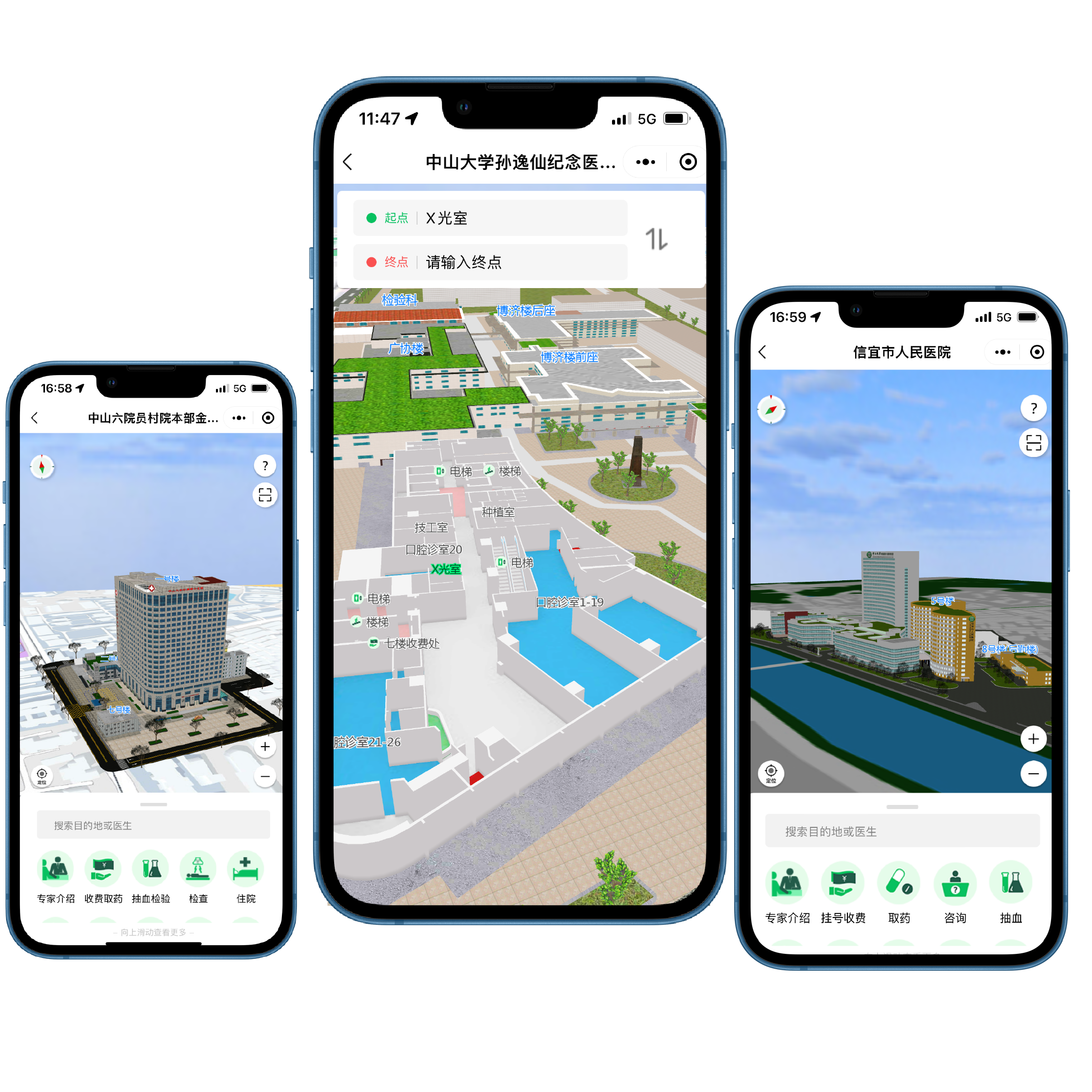
Indoor Map System
Provides indoor navigation mini-program and information kiosk solutions, including high-precision indoor navigation, real-time positioning, route planning, and other functions
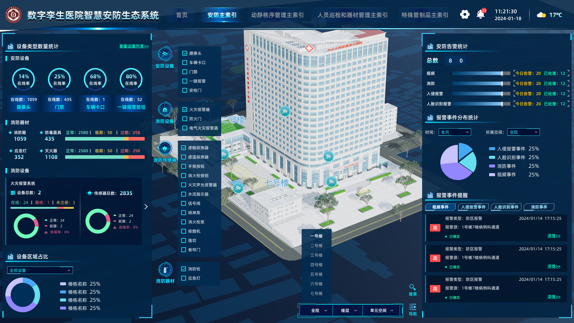
Digital Twin System
Builds comprehensive digital twin solutions, integrating 3D modeling, intelligent analysis, real-time monitoring, and other functions